Home

Little Brier Gap to Walker Sister’s Place – GSMNP

Leave a comment

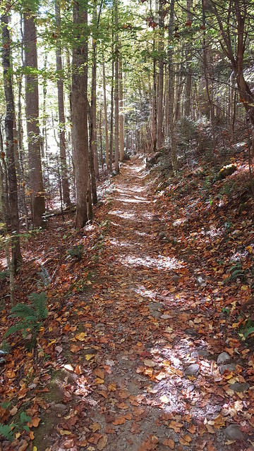
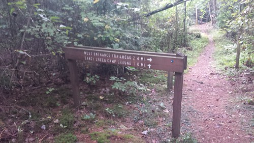
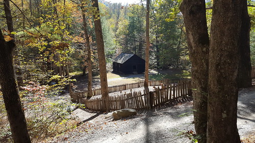
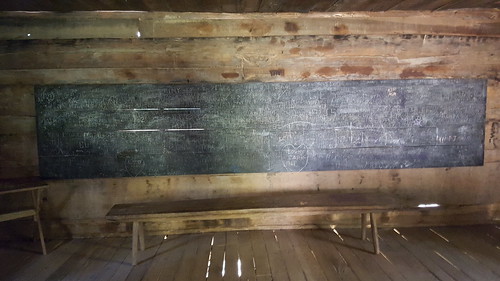
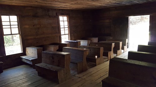
The trail head is located just north of MetCalf Bottoms picnic area.  It starts off at an old school house where classes were from taught from 1882 till 1935.

20161026_103351

20161026_103718

20161026_115409

20161026_103628

20161026_103636

20161026_103648

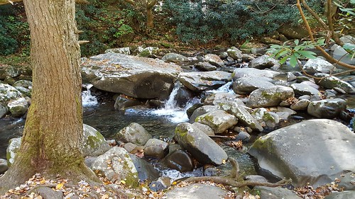
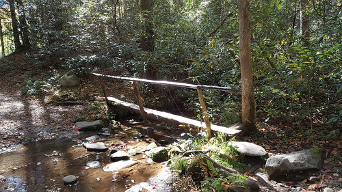
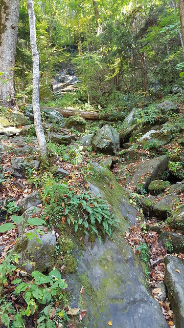
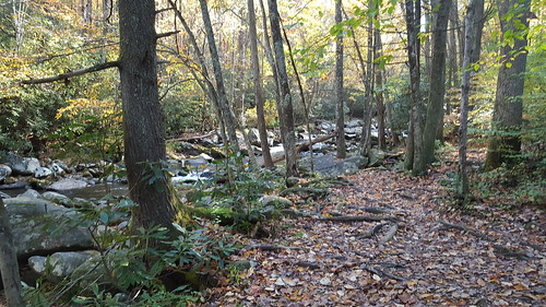
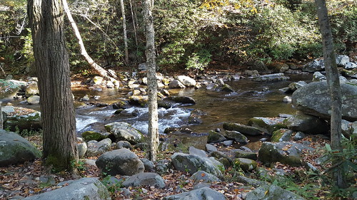
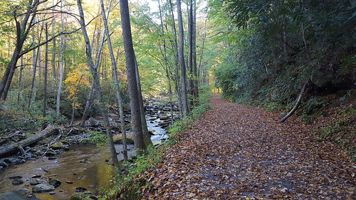
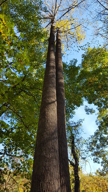
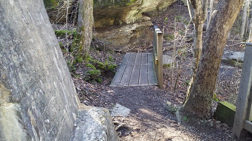
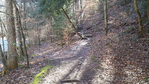
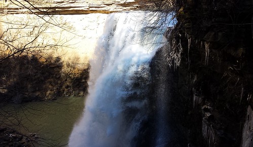
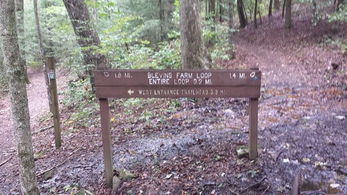
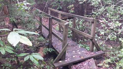
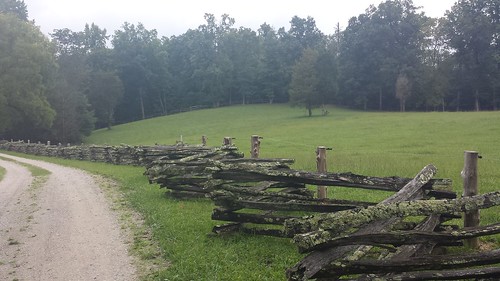
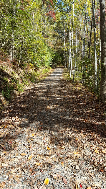
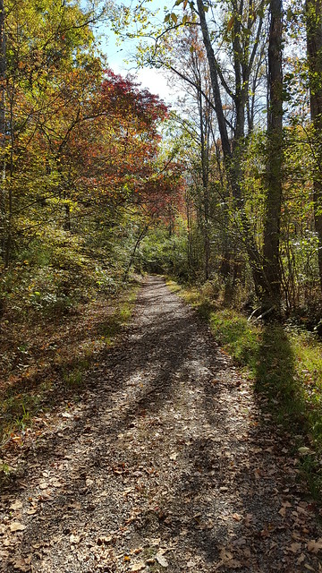
The trail follows along side a small branch called Little Brier Branch as it gradually climbs out of the hollow.  At about six-tenths of a mile, you will reach a foot bridge.

20161026_105801

20161026_104230

20161026_104640

20161026_105044

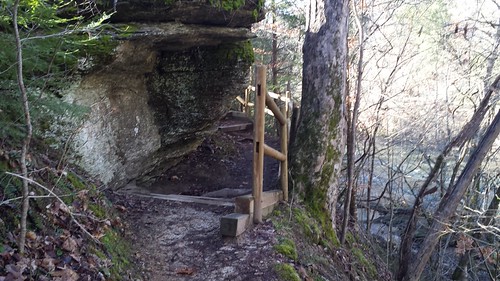
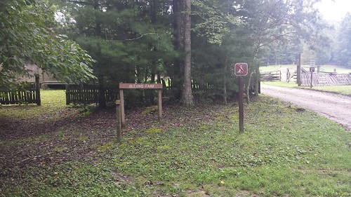
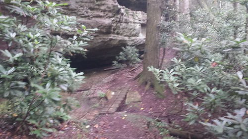
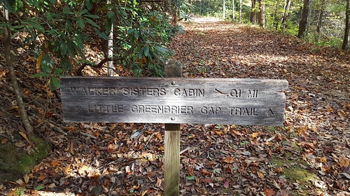
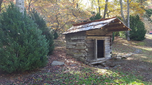
At about 1.1 miles you will reach the side trail that leads over to the Walker’s Sister Place a short distance away.
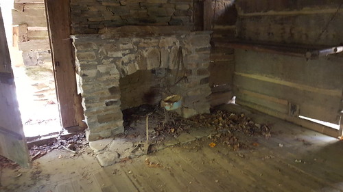
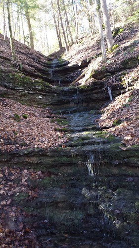
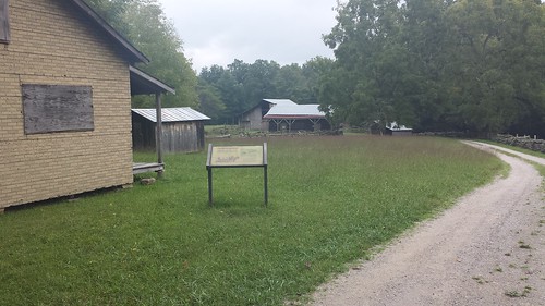
20161026_111215

20161026_111348

20161026_111603

Old Spring House.

20161026_111800

20161026_111808

20161026_112014

20161026_112229

20161026_112438

20161026_112615

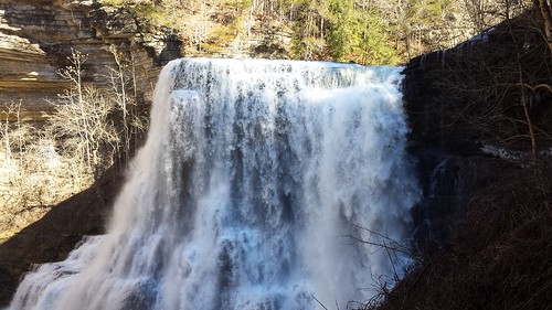
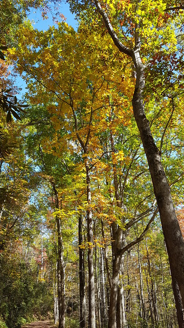
This was again a very pleasurable hike and it’s good to be able to learn about some of the history of the Great Smoky Mountains area.  Temperatures were perfect and nothing but sun in the sky.  For anyone interested in the history of the Walker Sister’s Place, I’ve quoted some information below, thanks for reading folks!


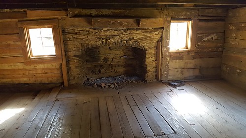
Little Green Brier achieved a degree of national fame as a result of the Walker Sisters. The five spinster sisters who lived here refused to sell their 123-acre farm to the national park, and were able to maintain their traditional mountain life into the 1960’s.

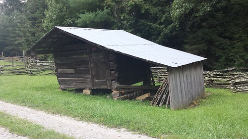
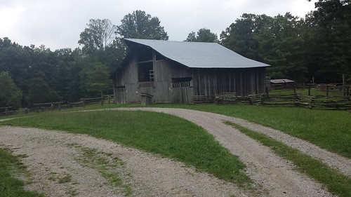
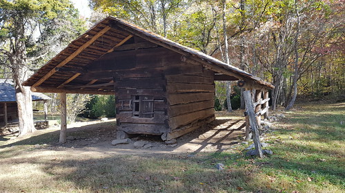
John Walker, a Union Army veteran, and his wife, Margaret, moved onto the homestead in 1870. Over the years, as his family grew to eleven children, John expanded the cabin and made several improvements to the farm. At one point the homestead consisted of several outbuildings, including a barn, blacksmith shop, applehouse, springhouse, smokehouse, pig pen, corn crib and a small tub mill. Today, only the cabin, springhouse and corn crib survive at the site.

In 1909 Walker deeded the land to his youngest son, Giles, and five of his daughters; Margaret (1870-1962), Martha (1877-1951), Nancy (1880-1931), Louisa (1882-1964) and Hettie (1889-1947). By this time the other children were already married and had moved away. After John died in 1921 the farm was passed to the five daughters (later in that same year Giles would deed his share of the land over to his sisters).

While the surrounding mountain communities slowly began to modernize after World War I, the Walker Sisters continued to pursue their traditional way of life, which emphasized independence and self-reliance. The five sisters would continue to raise sheep, grow crops, plow their own fields and make their own clothes from the wool and cotton they raised.

Change, however, would be forced upon the Walker Sisters. In the 1930s the Great Smoky Mountains Park Commission, responsible for purchasing property for the new national park, tried to persuade the sisters to sell their farm. Realizing that the park was wading into a public relations minefield, GSMNP Superintendent Ross Eakin sent a memorandum to the Director of the National Park Service on Nov. 18, 1939, stating; “These old women are ‘rooted to the soil.’ We have always understood they were to be permitted to spend the rest of their lives on their property. . . . If they were ejected from the park we should be subject to severe criticism, and in my opinion, justly so.”

Finally, in late 1940, faced with a condemnation suit, the Walker Sisters accepted $4,750 for their land, provided they were “allowed to reserve a life estate and the use of the land for and during the life of the five sisters.” On January 22, 1941, ownership of the Walker Sisters’ land finally passed to the national park. A local legend claims that President Franklin Roosevelt paid a visit to the sisters and convinced them to sell the farm to the new park. Although Roosevelt was in the area to dedicate the national park in 1940, there’s no evidence of him having visited the sisters.

The National Park Service assumed control of the land when Louisa, the last of the Walker Sisters, died in 1964. The National Park Service restored the cabin in 1976, and in that same year, all three surviving structures on the site were placed on the National Register of Historic Places.

Porter’s Creek Trail – GSMNP

Leave a comment

Today’s been a good day for a hike!  Porter’s Creek Trail was the trail and Fern Branch Falls the destination.  This trailhead is very close to another great trail called Ramsey Cascades.  Oh, and by the way, Ramsey’s is closed (trail maintenance?) so call the park before heading over if you have plans to do that particular trail.  Also, Alum Cave Trail is still closed Monday through Thursdays for trail maintenance.  Ok, enough about closed trails!

Where was I….oh, Porter’s Creek Trail!  The first mile or so of the trail goes along an old road that runs next to Porter’s Creek.  You will pass by some stone walls on your right at about 2/3 of the way in.  This is the old homestead of Elbert Cantrell.  Just pass the homstead you will see Ownby Cemetary on your right

20161025_105720

20161025_105845

20161025_125041

At the 1 mile mark, the old road turns into an actual trail and there’s a spur trail to the right that leads to the John Messer farm site.

20161025_111421

20161025_111847

20161025_111901

20161025_111931

Pic’s along the way…

20161025_105028

20161025_110045

20161025_105854

20161025_110509

20161025_113624

20161025_124546

20161025_123119

At 1.6 miles you will cross a footbridge.  I kept trying to get a shot that would make this bridge look more menacing but I couldn’t…It was a little nerve racking crossing it.  It’s a lot higher off the creek than it looks in the middle.  All was well, no rescue of a clumsy hiker needed today!

20161025_114831

20161025_122535

At 2 miles, I finally reach my destination, Fern Branch Falls.  There was barely a trickle at the very top.  Sorry pic is zoomed out.  I had read that the falls is pretty spectacular when there’s higher water flows, but honestly didn’t expect much with the lack of rain we’ve had lately.  Not disappointed, I’m sure it’ll start flowing when it gets ready.

20161025_120845

Did I say the trail was all up from the very beginning?  Well, it was.  Only 2 miles in, 2 miles out for a total 4 miles.  There were a lot of people on the trail today and I had the pleasure of speaking to a few.

Thank you all for reading!

Elkmont Campground / Cucumber Gap Loop Trail

2 Comments

Last night, I tent camped at Elkmont Campground in the Smokys.  I’ve had friends that have stayed there so I thought I’d give it a go.  I really enjoyed it a lot.  With no cell signal or wifi, I was absolutely forced to just enjoy the evening watching the fire and relaxing.  The campground sits right next to my planned hike for the following day so it made sense to tent camp at Elkmont, pack up the next morning and head to the trailhead.

20161023_155013

20161023_180643

20161023_212915

20161024_072117

I won’t bore you with a history lesson.  Google can teach you about the area if you’re interested in learning more about Elkmont.  Part of the reasons for this trail and my upcoming couple of hikes is the history around the area.  There are many old structures at the start and end of this trail that are really cool to see.  I never knew this “Elkmont Ghost Town” existed.

20161023_144733

20161023_144656

20161024_084006

20161024_084022

20161024_084211

My first hike for this week is the Cucumber Gap Loop Trail.  The trail is a total of ~5.7 miles and gains around 800 feet in elevation, about 400 of that feet is in 1 mile.  It’s rated moderate mostly because of the distance and the elevation.

The trail starts on Little River trail and runs adjacent to Little River for the first 2.5 miles and is absolutely beautiful.

20161023_160203

20161023_160157

20161024_084218

20161024_084321

20161024_084325

20161024_085016

20161024_085012

20161024_085940

20161024_092811

20161024_094251

20161024_091604

20161024_102636

At 2.5 miles the trail intersects with the Cucumber Gap Trail for the remaining portion of the trail.  This second half makes a fairly steep climb through the forest.  It’s eerily quite after hiking the first half next to the sounds of the river.  There are a lot of roots on this section and they seemed to like tripping me every other step!

Thanks for reading folks!

Headed to the Great Smoky Mountains National Park!

Leave a comment

Hello all!  Hiking season is upon us and I’m happy to be heading out for a little solo adventuring this coming week.  Destination GSMNP.  I’ve been wanting to do a trip like this for the past couple of years and I’m glad to finally be making it a reality.

Depending on signal/wifi, I’ll be trying to do trail reports daily.

Hello…Is there anyone out there? :)

1 Comment

Greetings…

Marathon Hike Update #3

Leave a comment

Greetings!  Darrin and I finished up the hiking marathon this week on Monday.  Knocking out the Hemlock Trail, Good Samaritan Trail and the Rotherham Trail.  I’m really liking this lower loop trail sections.   It’s got a lot of up’s and downs making this a good trail for some great exercise.  The “Hit the Trails” Festival is next weekend were we can pick up our t-shirt, patch and other goodies for completing the marathon.

Here is some info if you’re interested:

“Come and learn all about the outdoors in Fairfield Glade. We are looking forward to an exciting event again this year. We have expanded from being just about trails to include all outdoor activities available to Fairfield Glade and Cumberland County residents and visitors. Last year we had over 1,000 attendees so we are hoping for even more this year if the weather cooperates.

There will be live music and concessions stands selling burgers, hotdogs, etc. With over thirty information booths there will be plenty to interest everyone.

The Friends of Glade Trails will have trail maps for the old and new trails and volunteers available to answer all your questions. They will also provide guided walks on some of the trails.

Volunteers at all the other booths will be handing out information about their organization or activity.

If you have any questions please contact: John Conrad at

john@time2meet.com
or (931) 287-2432”

Marathon Hike Update #2

1 Comment

Hello all!  Darrin and I made some more headway this week on the September Hiking Marathon.  We completed the following trails:


Cumberland Mountain State Park Pioneer Short and Long trails.

Overlook Trail

Thornhill Trail

Rotherham Lane to Druid Hills Trail

McGinnis Creek Trail

Good Samaritan Trail

Canyon Trail


In order to complete the Marathon Hike we’ll need to finish up with Hemlock Trail, Good Samaritan trail (2nd time) and the Rotherham Trail.  Next week it won’t be possible for us to hike, but the week after we should be able to finish up.

Thanks for reading!

Marathon Hike

Leave a comment

Ok all, I needed something to kick-start myself so this is it! Darrin and I are signed up for a local event that challenges us to do a marathon of trails all in the month of September. There are two sets of trails:

1) Fairfield Glade Trails and 2) Cumberland County Trails. The event is free and if you complete half of the trails you get a t-shirt and if you complete the whole marathon you get the shirt and a patch along with entry in a raffle for many prizes. I meant to post earlier on here about the event but real life got in the way.

We started earlier this week and have completed 3 trails so far out of 6 in the “Cumberland County Trails” section.

On Tuesday the opening day, we did the Centennial Park trail:
“I’ve hiked this trail before but it’s been a while. New to me was the Dog park and the trail leading up to Genesis Road. It was nice to explore some in a park that’s become familiar.” Runkeeper link here.

Wednesday, we did the 1.9 mile trail on top of Renegade Mountain:
“This was a nice trail in an area that hadn’t been developed yet for housing. Trail was well maintained and after missing a turn off, we backtracked and finished the trail with no issues.” In regards of why we missed the turn off (because signage is awesome), I was breathing too hard and I think Darrin was worried I might have a heart attack! :).  Runkeeper link here.

Thursday we did the Soldier’s Beach Trail at Meadow Park:
“This is one that I found a few months ago but haven’t had a chance to hike. It was a fairly level trail and it was a nice hike. We found that this area used to be a local swimming hole back in the day. Good place to take the family on a nice and easy hike.”  Runkeeper link here.


Next week we hope to finish up with the Pioneer Short and Pioneer Long trails along with the Black Mountain Loop trail.

Just a note on past experience:
“I’ve done both the short and long Pioneer trail and it’s just a great trail. I call it my “training” trail for longer hikes. I’ve done the Black Mountain Loop trail to the “steps” and have branched off to the trail that leads off to hwy. 68 to continue on to the Brady Mountain area to Jewett Rd.” It’ll be nice to finally do the whole loop there and checkout the Northern Overlook!

I’ll post more as we progress! Thank you all for reading!

Burgess Falls State Park

Leave a comment

It has been awhile since I’ve been on the trail so today I decided to head off to Burgess Falls State Park.

Here’s a little history on the area (taken from Wikipedia):

Burgess Falls is named after Tom Burgess, a Revolutionary War veteran who settled along this section of the Falling Water River in the 1790s. The Burgess family used the river’s rapids to power a grist mill and eventually a saw mill which supplied early settlers with corn meal and lumber.

In 1924, the City of Cookeville built an earthen dam along the river a mile or so upstream from Burgess Falls. After a flood destroyed the dam in 1928, the city replaced it with a concrete dam that provided the area with electricity until the arrival of the Tennessee Valley Authority in 1944. Due in large part to calls from Cookevillians to protect the area, Burgess Falls State Park was established in 1971. Part of a pipeline bridge still spans the river in the vicinity of Little Falls. The pipeline originally crossed the river into a tunnel on the north walls of the gorge and emerged to cross the river again near Middle Falls en route to a powerhouse.

20150117_102453

20150117_102608


20150117_102905


Upper Falls

20150117_102923

20150117_102936

20150117_103119

20150117_104019


Middle Falls

20150117_104555


Lower Falls

20150117_105801

20150117_110246

20150117_110308

20150117_110345

20150117_110508

20150117_110634

20150117_110641

20150117_110930

20150117_110935

Here’s a short video!


Oscar Blevins Farm Loop Big South Fork National Park

Leave a comment

It’s been too long off the trail. Life, Work stress and all things have gotten in the way of something I really enjoy and it was time to head out on the trail again! I decided to go to BSF and give the Oscar Blevin’s Loop Trail a go. The trail is rated easy and only 3.7 miles in length. At the trail head be sure to pick up the pamplet named “A Guide to the Oscar Blevins Loop Trail”. Certain sections of the trail are numbered with a wood post and the guide will describe what the area was.

Quoting the guide, here is a little info on Oscar and Ermon Blevins:

“Oscar and Ermon Blevins were typical of many people who once lived in this area. They preferred to live an independent, self-sufficient lifestyle. They earned a living for themselves by working their small farm. Oscar supplemented his income by hunting and trapping the surrounding forest. Both have deep ancestral roots in the area. Their families were among the first permanent settlers in the Big South Fork region in the early 1800’s. Oscar and Ermon would have continued to live and work their farm had not their property been purchased by the government in 1980 for inclusion in the Big South Fork National River and Recreation Area. Oscar Blevins passed away in 1989 and Ermon Blevins died in 1994.”

With all the hustle and bustle of today’s lifestyle it’s nice to envision a simpler life. Pic’s and video of the hike below!

20140913_110746

20140913_110836

20140913_103333

20140913_111739


Slippery foot bridges!

20140913_114946

20140913_115357

20140913_115431

20140913_115437

20140913_115659

20140913_115703

20140913_115712

20140913_120054

20140913_123126

20140913_123925

20140913_124701

20140913_124856


Today’s temp’s were absolutely perfect for hiking.  It was overcast with a chance of rain but I managed to avoid the rain showers and really had a good time getting back on the trail.  Until next time folks!  Short video below:


Older Entries