Home

Burnt Mill Bridge Loop Trail

6 Comments

Hey guys, thought I would update the blog with another hike from Big South Fork today.  I promise I’ll start branching out soon and doing some hiking in another area, most likely in the Smoky Mountains.  Today’s hike was a moderate 3.6 miler, even though I ended up doing closer to 5 miles because I thought I had missed a trail and had to backtrack, then return to my original location.  Pic’s below!

20140222_094645

20140222_095117

Could barely find a parking place!

20140222_095110

20140222_095327

20140222_105909

20140222_110529

20140222_110555

20140222_110828

20140222_110844

20140222_111828

20140222_111956

20140222_112912

20140222_113827

20140222_123229

20140222_123342

20140222_124408

20140222_124839

20140222_125016

20140222_125818

20140222_131535

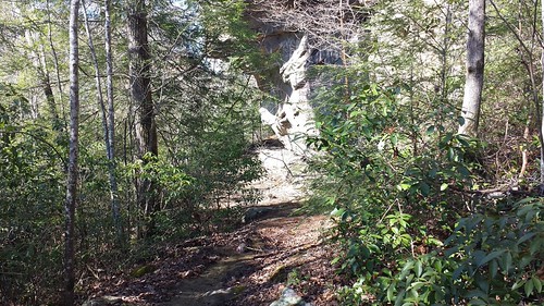
The trail was really wet in a lot of places.  With all the rain we’ve had lately, I was unsure if the trail would be underwater since this is the first time doing this trail.  Other trails in BSF like O&W, Angel Rapids, etc.. are not passable after heavy rains.  I lucked out at the end (shown above).  2 days ago, this area was flooded and would have required backtracking the whole trail or up to a road crossing and walking the road back.  Either way would have doubled the mileage.

Had a blast today, was nice to be out in the beautiful weather and enjoy some much needed sunshine!

Thanks for tuning in.  Runkeeper here.  Short video below:

Angel Falls Overlook – Big South Fork

6 Comments

I decided to do an overnight camp at my cabin, then head over to Big South Fork National Park for a hike this weekend. The trail was in good shape other than the last .10 of a mile to the summit. It was very icy. Here are some pics along the way and a short video at the end.

20140208_095244

Pictured above is of the bridge that you’re suppose to walk across to start this hike.  It’s damaged by flooding so you have to walk across the bigger bridge.  Not sure why they thought it a good idea to have a bridge like this…

20140208_095730

Destination is the start of the Grand Gap Loop then back.  The Grand Gap Loop is 6.8 miles in length.  I would have ran out of time if I had tried to do the loop all in one day.  This one will have to wait until the time changes in April.

20140208_095935

20140208_100042

20140208_100052

20140208_100353

Lots of icicles!

20140208_100407

20140208_100411

20140208_101233

20140208_102318

The trail follows along the side of the Big South Fork river for the  majority of the hike.

20140208_103624

20140208_103634

20140208_103753

20140208_104608

20140208_104717

20140208_104723

20140208_104728

20140208_110205

The overlook above.  The trail has a few switchbacks up to this area, probably lending to the moderate/strenuous rating.

20140208_110345

20140208_110408

20140208_110412

20140208_110350

20140208_110540

20140208_110730

This is where I turned around.  I had only .10 left to reach the overlook, but there was a lot of ice on the climb up and then cables you have to hold onto.  I couldn’t tell how much ice was on the edges and with having no microspikes and hiking solo, I thought I’d call it a bit short and return back down the trail.  When hiking alone, I try to be prepared and even keep in mind that if I had too, I could stay the night if something bad happened.  No need taking the chance though.  I’ll be back in early spring to finish this and the Grand Loop for sure.

20140208_111121

20140208_111433

20140208_111440

Video of the hike below and Runkeeper here:

Thanks for viewing!

-David